
Andrew Marsh 3D Sun Path Maps Walkthrough
Description
Learn how to visualize sun movement and shadowing for solar projects using Andrew Marsh's free 3D Sun-Path tool. Select any location, adjust date and time, and read sun altitude, azimuth, and daylight hours. This is essential for accurate shading analysis and solar production planning. Try the tool free: https://andrewmarsh.com/apps/ SOLAR TRAINING & CERTIFICATION Shading analysis is core NABCEP PV Associate exam material. Go deeper with our courses: 40-Hour NABCEP PV Associate Prep + full course catalog: https://ecotechtraining.com/solar-training Save 10% on any course with code ECOTECH10 CHAPTERS 0:00 Intro: How to put in a location 0:48 How to simulate sun movement 1:24 Change notable dates, times and shadowing 2:25 Moving the map to see different orientations of buildings 2:55 Seeing daylight and night hours chart Learn how to add custom buildings for your sun path simulation: https://youtu.be/UkRoxebfStc WATCH NEXT Components and Design of a Commercial Solar Farm: https://www.youtube.com/watch?v=ERPA7JjlnGE LFP vs LMFP Solar Batteries: Voltage, Cycle Life & Design Rules: https://www.youtube.com/watch?v=kFVYpgZi6Ic Questions about sun path analysis or solar design? Drop them in the comments. We answer every one. #SolarPlanning #SunPath #ShadingAnalysis #AndrewMarsh #SolarDesign #RenewableEnergy #NABCEP
 8:15How the Sun-path affects your designsImran Esmail
6.2K views
 9:15Mastering the sun path in under '10Pedro Augspach
11.2K views
 5:50Solar Geometry- How to read a sun-path diagramSculpting GRAVITY
47.1K views
 17:00Process for Designing Climate Specific Solar Shading DevicesCarmen Trudell
97.5K views
 16:03How to Create a Sun Path Diagram | Architecture Studentstoscaleblog
141K views
 21:05| Sun Path Diagram | Azimuth | Explained by Rohan Dasgupta |Dr. Rohan Dasgupta
20.2K views
 10:51Intro to Solar Orientation [Solar Schoolhouse]Solar Schoolhouse
1.1M views
 4:53How to design sun shading devices for your homeArchi notes
63.8K views
 4:56Reading Sun Path DiagramsEnergy vibe
64.5K views
 22:07Sun path diagrams for designing greenhouses, & solar greenhouses and high tunnels. Key differences!Brian White
443 views
 4:41HOW TO MEASURE SOLAR ANGLES | DEFINITIONSMinutes 2 Energy
88.5K views
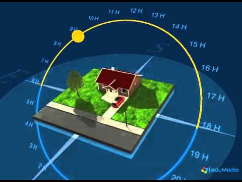 2:08The Apparent Path of the SunKurt Nilsson
225K views
 9:14The Earth's Sun AngleMS Meteorology
147K views
 15:07Chasing Shadows (Using a Sun Path Diagram)Planning to Garden
217 views